Path of Creation - «And saw that it was good»

The idea
Three Franciscan institutions in the region are behind the Path of Creation: the Franciscan Convent of St. Joseph in Muotathal, the Hildegard Hotel Haus St. Karl in Illgau, and the Antoniushaus Mattli in Morschach. Together, they have developed the idea of ​​meeting the human search for contemplation and simplicity with reflection and movement.
The Path of Creation brings them together: a pristine and ecologically valuable natural landscape, in-depth texts, and the simple act of walking. And the circular hiking trail connects three places and three houses committed to Franciscan-Clarian spirituality.

The houses
The houses - at the beginning and end of each route - are characterized by warm hospitality, wonderful locations and Franciscan spirit.
Those interested will find both simple and more elaborate meals and accommodations at the seminar and education center in Morschach, the Hildegard Hotel above Illgau, and the Muotathal women's monastery, which boasts over 700 years of tradition. They also enjoy insights into a rich history, a wide range of courses, space to relax, churches and chapels to linger in, and, in the monastery, an invitation to pray together with the small community of sisters.

  • Antoniushaus Mattli
    6443 Morschach
    Telephone 041 820 22 26
    info@antoniushaus.ch
    www.antoniushaus.ch

  • Hildegard Hotel Haus St. Karl
    6434 Illgau
    Telephone 041 811 10 93
    stkarl@bluewin.ch
    http://www.hildegardhotel.ch

  • Franciscan Monastery of St. Joseph
    6436 Muotathal
    Telephone 041 830 11 14
    gaestehaus@minoritinnen.ch
    www.minoritinnen.ch

The paths

The Path of Creation is a three-part spiritual hiking trail that leads through a landscape as diverse as it is beautiful, through a piece of creation that continually inspires new insights and wonder, bringing hikers into contact with the created world. All hiking and mountain trails are well-maintained, with only a few paved roads. Most of the trails lead across vast expanses, through shady forests, wonderful flower meadows, along the rousing Muota River, or alongside a murmuring mountain stream. Even though the hiking times are generous, each stretch is equivalent to a full-day hike, which, due to the elevation changes, may require some sweating. All three stages are also easily accessible for families with children and can be shortened by post bus or cable car. Since there are only a few inns along the trail, it's advisable to carry food in your backpack. The three Franciscan houses are ideal for overnight stays.

Meditation texts

inventory

A heart full of breadth.
An eye full of green.
A nose full of grass.
An ear full of thrush.
A belly full of summer.
A lung full of happiness.
A handful of finitude.

The Way of Creation is special not only for its scenic beauty, but also for the depth of its text. Theologian Jacqueline Keune has written short and very short reflections that line the three stages of the path on 25 oak text columns. Being on the move, always toward a Franciscan goal, thus means more than just movement.
The short meditations do not simply want to convey in words what the eyes of the hikers and pilgrims see, but rather to continue it in their own way – in spiritual and religious breadth.
Last but not least, the texts draw on the tradition of the Franciscan hymn to creation—a hymn that doesn't express itself in a romanticized way, but also identifies the limits of creation.

Routes and directions

Route I: Morschach – Illgau (hiking time approximately 6 hours)

Antoniushaus Mattli – Marienkapelle – Degenbalm – Schwyzerhöhe – Oberschönenbuch – Suworow Bridge – Schlattli – Aufiberg – Lottenbach – Caisten – Handgruebi – Gründel Chapel – Hildegard-Hotel Haus St. Karl,

From Mattli (646 m), the trail leads through a wooded area toward the Marienkapelle (St. Mary's Chapel). After about 500 meters, we turn left and, after a short climb, reach the church. At the crossroads, we turn left toward Schwyzerhöchi, then right after a few meters, climb to the Lourdes Grotto and continue to the Degenbalm hill (720 m). Here, we follow the trail to Schwyzerhöchi (756 m) to the main road, which we leave after about 200 meters and turn left toward Oberschönenbuch/Suworowbrücke/Schlattli. The trail continues on a gently sloping, quiet asphalt road—the Schwyzer valley basin in all its beauty below us. At the "Wanderweg" junction on the left, we leave the trail and continue along the stream, with the striking pair of Mythen peaks in front of us. At the next fork in the path, we turn onto the narrow meadow path behind the large stone and briefly follow the stream again. In Oberschönenbuch (540 m), we turn right and take the flat nature trail towards Schlattli. From the famous bridge (533 m), we soon reach the valley station of the Stoosbahn, the Schlattli (569 m). Here we cross the zebra crossing, walk a few steps towards Schwyz, turn right into the entrance to the car garages, and climb up through meadows to the sparsely used road, where we turn right. With a magnificent panorama before us, we hike in steady, sweeping switchbacks up to the beautiful hamlet of Aufiberg (769 m). Towards Lotenbach/Handgruebi, the trail climbs gently over meadows to Lotenbach (829 m). Here we turn right towards Hand/Iberegeregg. Over the lively stream, we now climb steadily over moor-like expanses to the point of Chaisten (915 m). After 200 meters, we follow the "Bergwanderweg" junction toward Hand. In Handgruobi (1029 m), the paved road leads us toward Ibergeregg, and after about 1 kilometer, we continue toward St. Karl/Illgau. After about 500 meters, we pass the Gründel Chapel and climb left into the small woods, which leads us along a shady path directly to Haus St. Karl (1165 m).

Abbreviations
by post bus: Morschach – Schwyzerhöchi and Schwyz – Schlattli

Route II: Illgau – Muotathal (hiking time approximately 4 hours)

Hildegard-Hotel Haus St. Karl – Wart Chapel – Nühus – Illgau – Ried cable car station – Vordere Brücke – Tristel – Herreblätz – St. Josef Monastery

From Haus St. Karl, the gently descending hiking trail leads us down to the right along beautiful meadow paths towards Wart/Illgau. A wonderful panorama of the Muotatal mountains opens up before our eyes. Soon, we see the small Wart Chapel (1067 m) below us. About 800 m after the chapel, we follow the "Bergwanderweg" junction. In the hamlet of Nühus (962 m), we cross the road and hike across beautiful meadows towards Illgau. Once in the village, we first follow the road down towards Ried/Muotathal, past the magnificent sexton's house and the church. After about 500 m, we turn left onto the hiking trail, which takes us in several sweeping switchbacks through shady forest and the sound of a high waterfall down to the Ried-Muotathal cable car station. We then walk about 500 m along the sidewalk of the main road to Muotathal. At the front bridge (584 m), we cross the road and take the path towards Tristel/Muotathal. Passing fruit trees, meadows, and rocks, we reach the hamlet of Tristel (623 m). Here we follow the turnoff to Muotathal. The wide, foaming Muota River now carries us along. Through a shady forest strip, with a variety of short ups and downs, we reach the village of Muotathal. Behind the elevated village church, the equally spacious and wonderful grounds of the Franciscan Convent of St. Joseph spread out before us in magnificent surroundings.

Abbreviations
Cable car St. Karl – Illgau
Illgau – Ried cable car
Postbus Ried – Muotathal

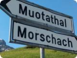
Route II: Illgau – Muotathal (hiking time approximately 7 hours)

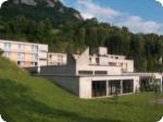
St. Joseph's Monastery – Tschalun – Hintere Brücke – Chapf – Stali – Äbnet – Frutt – Goldplangg – Uf den Gütschen – Wannentritt – Laubgarten – Geissbützen – Rinderchruteren – Stoos – Degenbalm – Marienkapelle – Antoniushaus Mattli

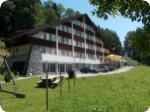
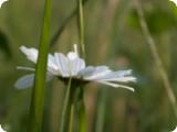
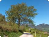
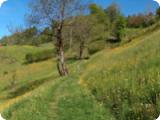
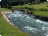
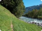
From the Franciscan monastery, we hike along a beautiful meadow path on the left side of the Muota (in the direction of travel) to Hinterthal (627 m), where we cross the river over the Hintere Brücke (back bridge). The path continues gently uphill toward Hürital and Liplisbüel on a quiet asphalt road, always following the yellow hiking trail markers. In Hürital (675 m), the path continues toward Chapf. About 150 meters after the hamlet, we follow the red and white "Bergweg" sign up to the left. The beautiful and varied nature trail soon brings us to the Chapf junction (731 m), where we catch our first glimpse of the mighty Hüribach stream. We cross the road and enter the forest toward Liplisbüel (red and white markers). From here, the path continues uphill, sometimes somewhat steeply. The impressive flow of the Hüribach stream more than compensates for the effort, and it's worth stopping for a while. Almost reaching the summit, we leave the forest and follow a narrow path onto a quiet road that crosses the stream and leads us gently downhill to the (unmarked) Äbnet point (an open meadow with an old barn). Here we turn left and take the comfortable dirt road. The path climbs gently through partial shade, with a wonderful panorama before us: the entire valley below with the winding Muota river, diagonally opposite the sunny terrace of Illgau, and high above the mighty Mythen. At Fruttzopf (1062 m), a bench invites us to rest and admire the scenery.
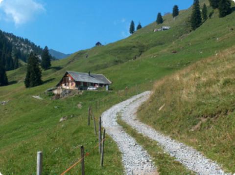
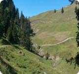
We continue towards Goldplangg/Riemenstalden. At the Frutt junction (1083 m), we take the path to the left. After a short climb through a sparse forest, the vastness and beauty of Goldplangg opens up before us. Following the red and white markings, the sunlit path leads us steadily uphill – with some challenges here and there – in generous bends over small hills and past scattered alpine huts up the mountain. Magnificent views lie before and behind us. At the stable with a large boulder, we do not branch off onto the red and white marked path, which continues straight ahead and on a level surface, but stay on our path and keep to the right. We soon reach the small alpine farm Uf den Gütschen (1542 m), where we can take another rest.
At the biker marker, we follow the beautiful, gently ascending mountain path to the right, which leads us along the mountainside to the (unmarked) Wannentritt pass. The beauty surrounding the striking Planggstock (1,761 m) once again makes us look and marvel.
We follow the trail markings towards Stoos and soon reach the highest point of our hike (around 1650 m) and shortly afterwards the beautiful Alp Laubgarten (1600 m), which lies on a wonderful small plateau.

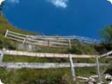
Now it's all downhill. The trail continues downhill on a beautiful, wide alpine path, initially a little steeper. We can already see our next destination in the distance: Stoos. At the junction with the large boulder, we take the path down to the right, past the Geissbützen alpine farm and the Tröligen plain (1,407 m), always heading towards Stoos. At the next fork in the path, which offers two routes towards Stoos, we follow the sign "Stoos 1 h". From Rinderchruteren, the path continues almost entirely flat towards the village. At Brunnerboden (1,320 m), we leave the road and continue straight ahead on a flat path towards the Stoos mountain station. We soon reach the small village (1,275 m), where numerous opportunities for rest and refreshments await.
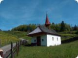
We continue towards Morschach. A comfortable and light forest path leads us downhill in beautiful curves. Gaps in the trees reveal wonderful views of the Schwyz valley basin. With the cable car station already in sight, we follow the Degenbalm Panorama/Morschach junction. A narrower path soon brings us to the edge of the forest, where another magnificent view awaits us. A few steps lead us down to the hamlet of Degenbalm, where we shortly leave the paved road and descend to the left to the Lourdes Grotto. At the farmhouse, we turn left and follow the Chapel Trail marker at the junction.

Abbreviations
Stoos – Morschach cable car